
Conditions are expected to improve Monday, but expect winter driving conditions in the morning
Environment Canada continues to warn Toronto residents that major wind gusts are possible throughout the night as a “major” windstorm affects the city.
Wind from the storm could be strong enough to blow shingles off roofs, uproot trees and cause power outages, the national weather agency said.
“We’re still expecting strong gusts. In fact they may gust up to about 95 km/h through tonight, so we are going to be continuing the wind warning,” Mitch Meredith, severe weather meteorologist with Environment Canada, told CBC Toronto.
“The precipitation, it’s been changing to flurries and we expect the temperature to continue to drop tonight down to a low of minus-7, so those flurries could be heavy at times and with the gusting winds, that will create blowing snow so there could be a little bit of concern with travel tonight.”
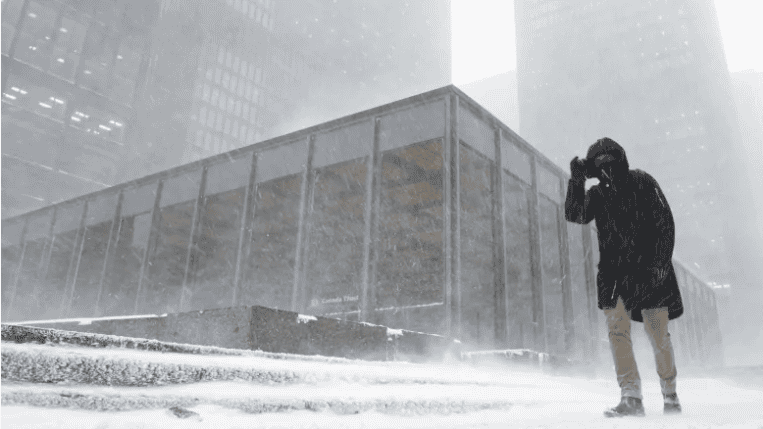
A wind warning and blowing snow advisory for Toronto and surrounding regions remained in effect on Sunday night.
“Gusts up to about 90 or 95 km/h are possible even into early Monday morning,” Meredith said.
Some of those effects are already being experienced.
As many as 5,000 people lost power in a small pocket in the Jane and Finch area shortly after 4 p.m., according to Toronto Hydro. But the utility said restoration of electricity would take no more than four hours.
Wind could toss loose objects
Environment Canada said the “damaging” winds are the result an arctic cold front that is expected to pass over the GTA.
“Loose objects may be tossed by the wind and cause injury or damage,” the federal weather agency said in the warning.

Motorists are being told to adjust plans accordingly if road conditions change due to the high winds.
The Niagara region, Prince Edward County and areas close to the northern shores of the Great Lakes are expected to be hardest hit by high winds.
Hydro One says about 27,000 people across Ontario are currently without power, with the most widespread outages concentrated around the Niagara and Hamilton areas.
Travel could be hazardous
Because of the possible whiteout conditions, travel could be hazardous and visibility reduced to near zero suddenly.
Travellers are urged to check with airlines for the status of their flights before heading to either Toronto’s Pearson International Airport or Billy Bishop Toronto City Airport.
The TTC, meanwhile, said trains will run at slower speeds in open areas of the subway.
Conditions are expected to improve Monday but Meredith said commuters should expect winter driving conditions Monday morning.
“We are going to be back to a little bit of winter driving conditions. Definitely the surfaces will be frozen. Morning temperatures of about minus-6 or minus-7 [are expected], he said.
“Even with a little bit of flurry activity it could be a little bit slippery in the morning on the untreated surfaces.”